Pratt
Lake Basin
After planning a
Venturing Crew outing for the weekend, only one of the nine young men in our
unit was able to attend. Wrangling a friend from another unit
and a second adult leader, the four of us headed out to the Alpine
Lakes Wilderness to enjoy an early season 11-mile round-trip hike to Pratt Lake
Basin. We started at the Talapus Lake Trailhead and passed by
Talapus and Olallie Lakes before reaching our campsite on Pratt Lake.
While the weather forecast threatened us with rain, we
enjoyed a dry hike all the way in. After setting up camp and
enjoying a relaxing dinner, the rain started in earnest, and we dove
into our tents around 8pm. We woke up to sleet the next
morning and hiked out of the basin with some snow showers. As
we descended elevation, the snow turned to rain, but that didn't stop a
fair number of day-hikers making their way up the trail to some of the
lakes. A photo album of the hike is available here. A detailed trip report is available on the Washington Trails Association website here.
|
3/2015 Alpine Lakes Wilderness, WA |
 Glass-like conditions on Talapus Lake in the early evening. |
GPS Info
We collected all of the following data from our GPS unit during the adventure:Maps
This Google Map is provided by GPS Visualizer
Elevation Profile
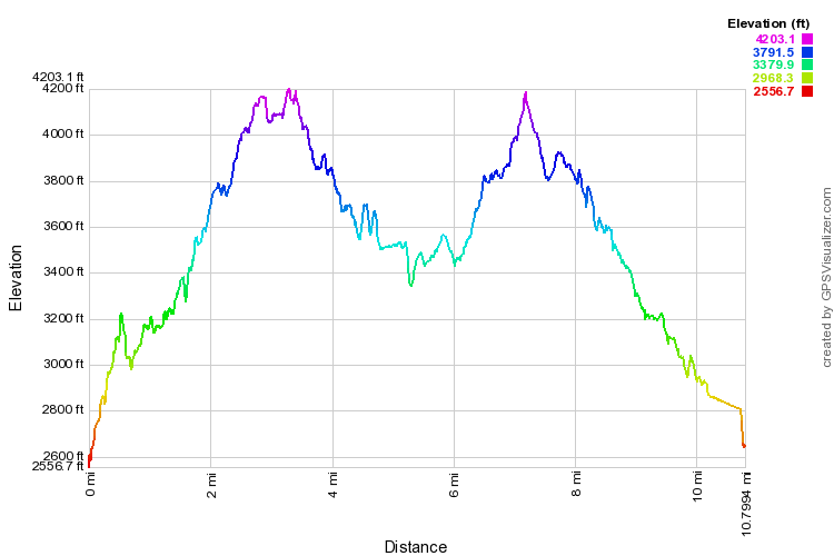
This profile is provided by GPS Visualizer
Coordinates and other details
|
10.8 Miles 04:29:53 2.4 Miles/Hr. N 47º 24.062 W 121º 31.111 |
If you would like to use this info with your GPS unit, the full GPX file is here.
If you want to view this in Google Earth, you can download the KMZ files of the track and topographic overlay.