Ponderosa
Pines Scenic Byway
The
Ponderosa Pines Byway follows Highway 21 from Boise,
ID to Stanley,
ID. This page records the northern section from
Lowman. The last half of this drives provides some amazing
vistas of sweeping alpine meadows and the aptly-named Sawtooth
mountains.
|
06/08/2007 Idaho State Highway 21 |
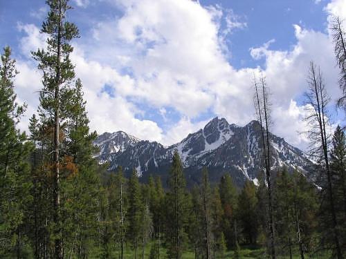 McGown Peak - One of the Northernmost Peaks in the Sawtooths visible from the Ponderosa Pines Scenic Byway |
GPS Info
We collected all of the following data from our GPS unit during the adventure:Maps
This Google Map is provided by GPS Visualizer
Elevation Profile
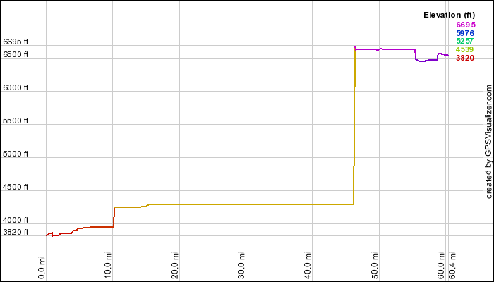
This profile is provided by GPS Visualizer. (We don't believe that this profile is correct at all, except for the starting and ending elevations. It looks like our GPS just plain wasn't tracking elevation gain from about mile 10 to about mile 47. We'll update this profile the next time we do this drive.)
Coordinates and other details
|
60.5 Miles 04:38:30 13 Miles/Hr. (Slow going... too much to see and too many pictures to take!) N 44º 04.953, Wº 115 36.872 N 44º 14.837, Wº 115 03.962 |
If you would like to use this info with your GPS unit, the full GPX file is here.
If you want to view this in Google Earth, you can download the KMZ files of the track and topographic overlay.