Pilot
Butte Hike
One of the
highlights of our Central Oregon getaway was this hike to the top of an
old cinder cone volcano in Bend, Oregon. With commanding views of
the Cascades,
we were highly impressed that we could see the entire Oregon Cascade
range, all the way up to Mount Hood, over 90 miles away! While we
were expecting to be able to drive to the top of the butte, the road is
closed during the winter season, but the 2-mile, 500-foot hike to the
top was well worth the view.
|
2/16/08 Pilot Butte |
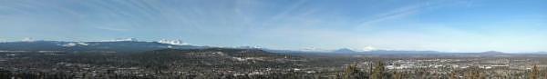 This 7-Frame Panorama of the Central Oregon Cascades includes views of Mt. Bachelor, Broken Top, The Three Sisters, Three-Fingered Jack, Mt. Washington, Mt. Jefferson, and Mt. Hood. |
GPS Info
We collected all of the following data from our GPS unit during the adventure:Maps
This Google Map is provided by GPS Visualizer
Elevation Profile
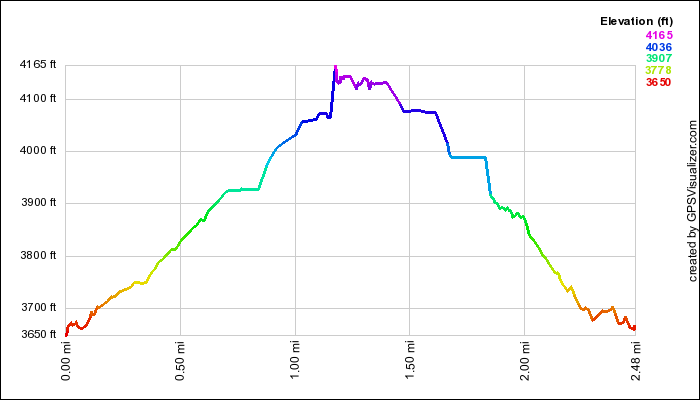
This profile s provided by GPS Visualizer
Coordinates and other details
|
0.6 Miles 00:28 1.3 Miles/Hr. N 44° 3' 27.79", W 121° 16' 42.45" |
If you would like to use this info with your GPS unit, the full GPX file is here.
If you want to view this in Google Earth, you can download the KMZ files of the track and topographic overlay.