Payette
River Scenic Byway (North)
While we had
already driven the Southern
section of the
byway several times, we haven't explored or recorded the
northern half of it very much, so we wanted to make a page dedicated to
the entire drive. The northern half is very beautiful as it
winds through the Payette
National Forest, right along the rapidly flowing North Fork
of the Payette River, which is considered by some experts to be one of the most challenging river reaches in North America, if not the world. We took quite a few pictures of the
entire camping trip that can be seen here.
|
7/26/2008 North Fork, Payette River |
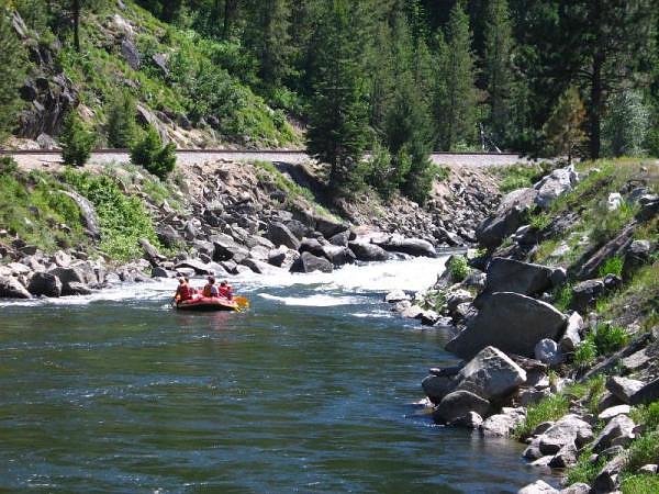 Rafters prepare for rapids along the North Fork of the Payette River. |
GPS Info
We collected all of the following data from our GPS unit during the adventure:Maps
This Google Map is provided by GPS Visualizer.
Elevation Profile
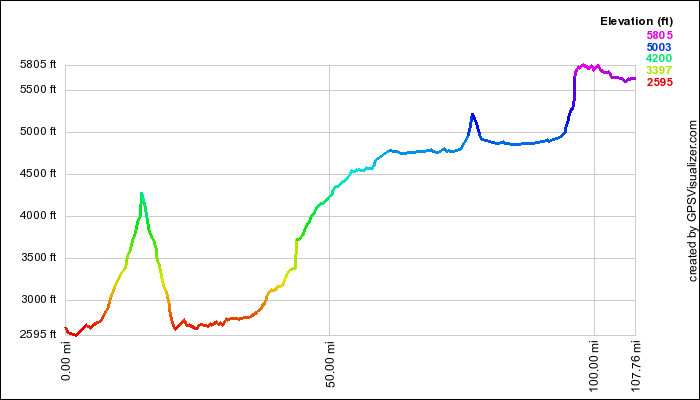
This profile is provided by GPS Visualizer.
Coordinates and other details
|
108 Miles 02:16:02 48 Miles/Hr. |
If you would like to use this info with your GPS unit, the full GPX file is here.
If you want to view this in Google Earth, you can download the KMZ files of the track and topographic overlay.