On a rarely quiet Saturday, we decided to take the opportunity to go exploring on an Autumn drive. We chose the Mountain Loop Scenic Highway in the Mount Baker-Snoqualmie National Forest for our destination. We had hoped to see some fall color, and did find a little, but not quite as much as we were hoping for. We also took the opportunity to stretch our legs at some of the smaller trails in the area to see some waterfalls, alpine lakes, rain forests, and the Big Four Ice Caves, named not for the caves themselves, but for Big Four Mountain, the base of which comprises a permanent ice field due to its constant shade on the north side of the steep mountain. While the caves are not to be entered due to the danger of cave-ins and avalanches, we nevertheless got to appreciate how large the two openings were based on others who did approach and enter inside.
|
10/2010 |
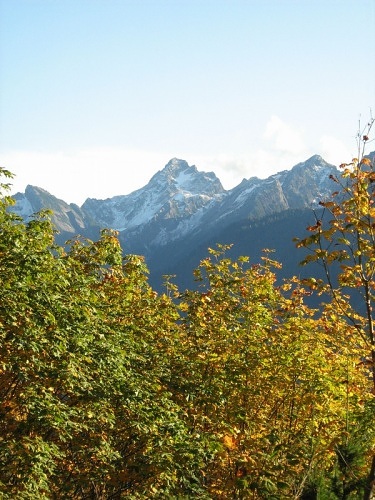
Del Campo Peak is framed by some fall color in this picture from Forest Road 4060. |
GPS Info
We collected all of the following data from our GPS unit during the adventure:Maps
This Google Map is provided by GPS Visualizer
Elevation Profile
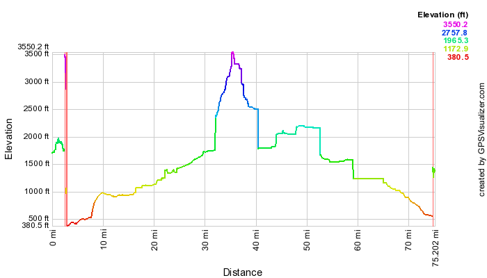
This profile is provided by GPS Visualizer
Coordinates and other details
|
71.9 Miles |
If you would like to use this info with your GPS unit, the full GPX file is here.
If you want to view this in Google Earth, you can download the KMZ files of the track and topographic overlay.