Military
Reserve Geocaching

Adjacent to downtown Boise sits an old Military Reserve. Now reserved as a city park, it offers nearly 500 acres of excellent mountain biking, hiking, and views of Boise, the Treasure Valley, and the Owyhee Mountain range on the other side of the valley. Mike took the kids up during an early spring weekend to do some geocaching as well.
|
3/28/08 Military Reserve Park Elephant Rock trail loop Policeman's Clubhouse Three Bear Creek Trail No. 1 High Hollow |
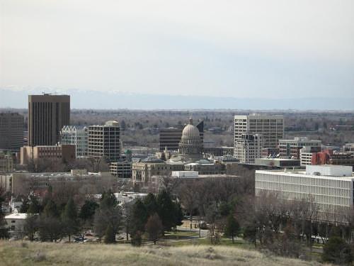 Downtown Boise from Elephant Rock Loop Trail |
GPS Info
We collected all of the following data from our GPS unit during the adventure. Since this track is a mixed hiking/driving map, colors are used to indicate speed. Red and orange sections denote hiking, whereas blue and green colors depict driving through the park to get from one cache to another.Maps
This Google Map is provided by GPS Visualizer
Elevation Profile
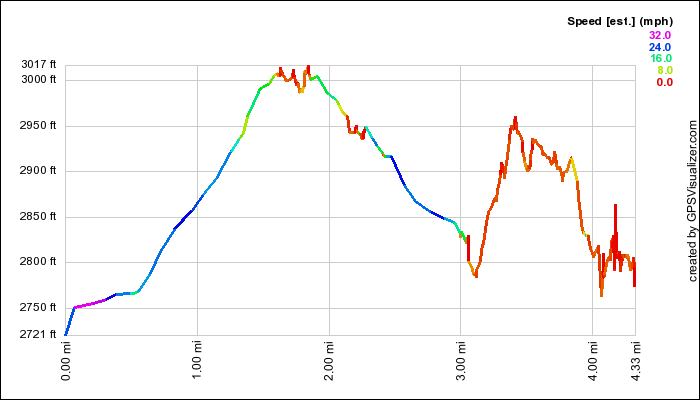
This profile s provided by GPS Visualizer
Coordinates and other details
|
4.3 Miles 1:50:30 2 Miles/Hr. (mixed driving/hiking) Refer to individual geocache pages above for coordinates to each cache. |
If you would like to use this info with your GPS unit, the full GPX file is here.
If you want to view this in Google Earth, you can download the KMZ files of the track and topographic overlay.