Lake
Serene Hike
As a first hike of
the season, BSA troop 655 took a 50-miler preparation hike to Lake
Serene in the Mt.
Baker-Snoqualmie National Forest on Highway 2 near Index, WA.
We enjoyed great weather and enjoyed seeing the Lower Bridal
Veil Falls, a rather frozen Lake Serene, snow-covered Mount
Index, and an abandoned copper mine that the boys thought was cool, yet
eerie. Pictures are available here.
|
3/26/2016 Index, WA |
 Lake Serene and much of Mount Index remains frozen during an early-season hike. |
GPS Info
We collected all of the following data from our GPS unit during the adventure:Maps
This Google Map is provided by GPS Visualizer
Elevation Profile
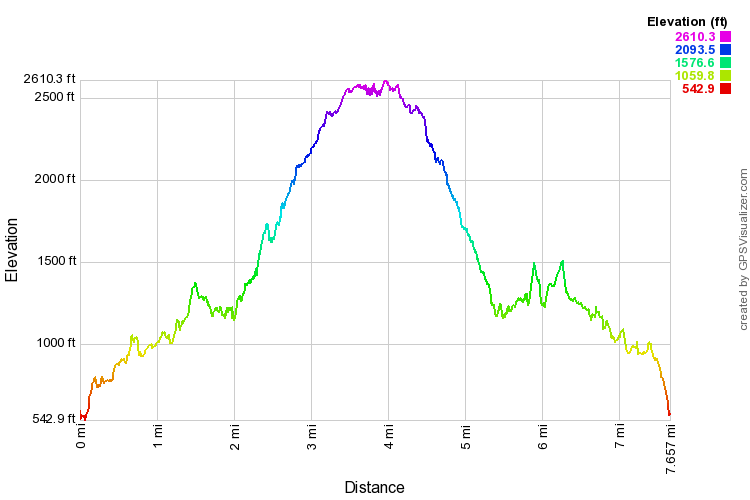
This profile is provided by GPS Visualizer
Coordinates and other details
|
7.7 Miles 6:14:35 (total), 4:04:37 (moving) 1.28 MPH (total), 1.88 MPH (moving) N47° 48.559' W121° 34.423' |
If you would like to use this info with your GPS unit, the full GPX file is here.
If you want to view this in Google Earth, you can download the KMZ files of the track and topographic overlay.