Kennally
Creek Hike
In our Idaho camping guide book, we found a really cool
campground nestled in the Payette
National Forest.
At the campground,
a trailhead begins along the Kennally Creek, which was swollen with
snow run-off during our visit. A five-mile round trip hike
through dense forest, by grassy meadows, over slithering snakes
(*gulp*) and the cascading creek.
We were away from everyone (we literally came across nobody!)
made for a very enjoyable hike. By the way, while leading the
group, it was Raymond who stepped right over the racer snake before he
realized what it was. He got himself out of there in a flash,
and was freaked out for a while. We even found a geocache way out along the trail, and it had only been partially-eaten by some curious critter who found it before we did.
|
7/27/2008 Payette National Forest |
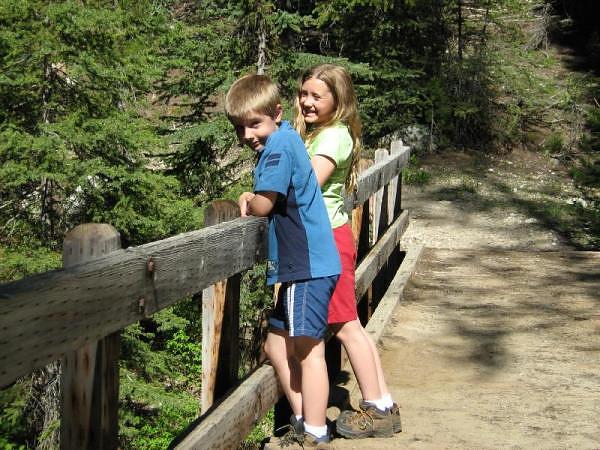 Kids take a moment to enjoy the rushing North Fork of the Kennally Creek as they stand on the bridge along the trail. |
GPS Info
We collected all of the following data from our GPS unit during the adventure:Maps
This Google Map is provided by GPS Visualizer.
Elevation Profile
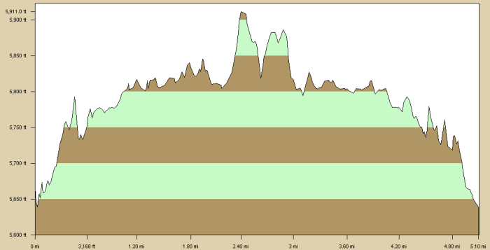
This profile s provided by Delorme Topo USA
Coordinates and other details
|
5.1 Miles 03:23:09 1.5 Miles/Hr. N 44 46.870, W 115 52.451 |
If you would like to use this info with your GPS unit, the full GPX file is here.
If you want to view this in Google Earth, you can download the KMZ files of the track and topographic overlay.