Dagger
Falls Drive
By definition a
wilderness area typically precludes vehicular activity of any sort.
One exception to that is a road that ventures into the Frank
Church River of No Return Wilderness, the largest wilderness area in
the contiguous 48 United States. The road was allowed in
order to provide white water enthusiasts with access to the Middle Fork
of the Salmon River. For us, the highlight of this trip was
watching a kayaker put-in just above the falls during peak run-off of
an exceptionally snowy year. What a ride!
|
06/09/2006 Frank Church Wilderness |
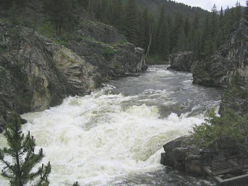 Dagger Falls on the Middle Fork of the Salmon River. We saw a kayaker completely disappear in the froth for a second or two shortly after putting in above the falls! |
GPS Info
We collected all of the following data from our GPS unit during the adventure:Maps
This Google Map is provided by GPS Visualizer
Elevation Profile
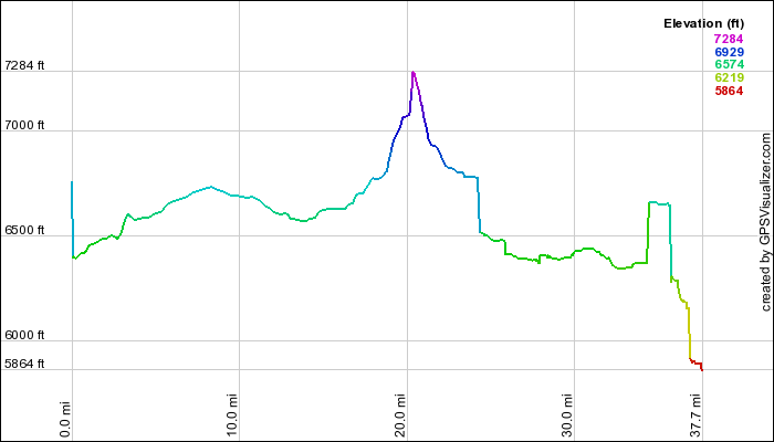
This profile is provided by GPS Visualizer
Coordinates and other details:
|
37.5 Miles 1:23:00 27.0 Miles/Hr. N 44º 15.513, W 114º 59.782 N 44º 31.719, W 115º 17.169 |
If you would like to use this info with your GPS unit, the full GPX file is here.
If you want to view this in Google Earth, you can download the KMZ files of the track and topographic overlay.