Bogus
Basin Tubing
During the winter
break, Mike took Amelia & Raymond to the tubing
hill at Bogus
Basin Ski Resort. While it was about 37 degrees ,
the wind was blasting snow in our faces at about 25 miles per hour.
We could only handle the biting cold for an hour and a half
of our two-hour session on the hill. The kids had a blast
anyway, and I'm sure we'll be heading back up there. While we
didn't take any pictures, we did want to show our GPS data that
indicates tube speeds of up to 25 MPH, coming down the 800-foot long
hill.
|
1/2/07 Bogus Basin Ski Area |
GPS Info
We collected all of the following data from our GPS unit during the adventure:Maps
This Google Map is provided by GPS Visualizer
Elevation Profile
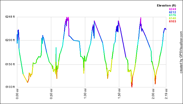
This profile is provided by GPS Visualizer
Speed Profile
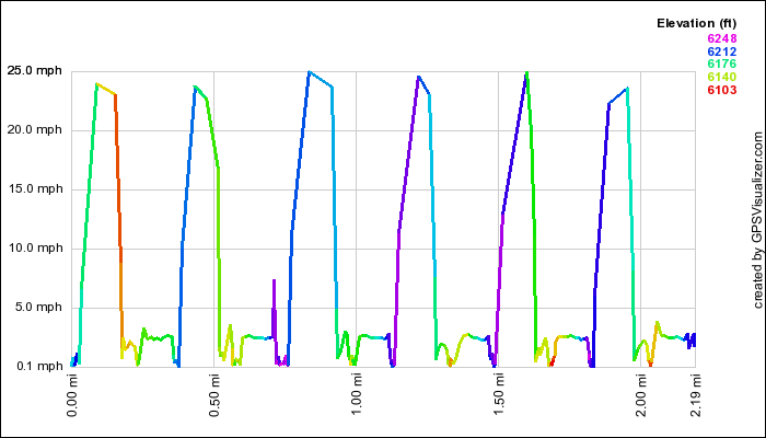
This profile is provide by GPS Visualizer
Coordinates and other details
|
0.6 Miles 00:28 1.3 Miles/Hr. N 43° 41 52.26, W 116° 6 31.74 |
If you would like to use this info with your GPS unit, the full GPX file is here.
If you want to view this in Google Earth, you can download the KMZ files of the track and topographic overlay.